A ‘powerhouse storm’ is approaching Middle Georgia. Here’s when it’s expected to arrive
We aren’t done yet. Get ready for more severe weather, Middle Georgia.
Friday’s forecast is in and it’s a doozy. According to Accuweather, a “violent” storm is headed our way.
Here’s what we know:
The main threats
It’s almost time for Round 2, and watch out, this weather is packing a punch.
Accuweather is calling it a “powerhouse storm” and it is expected to bring severe thunderstorms to the area. Several parts of Georgia, including Macon and Bibb County, are at a moderate or slight risk of threats like heavy rain and high winds.
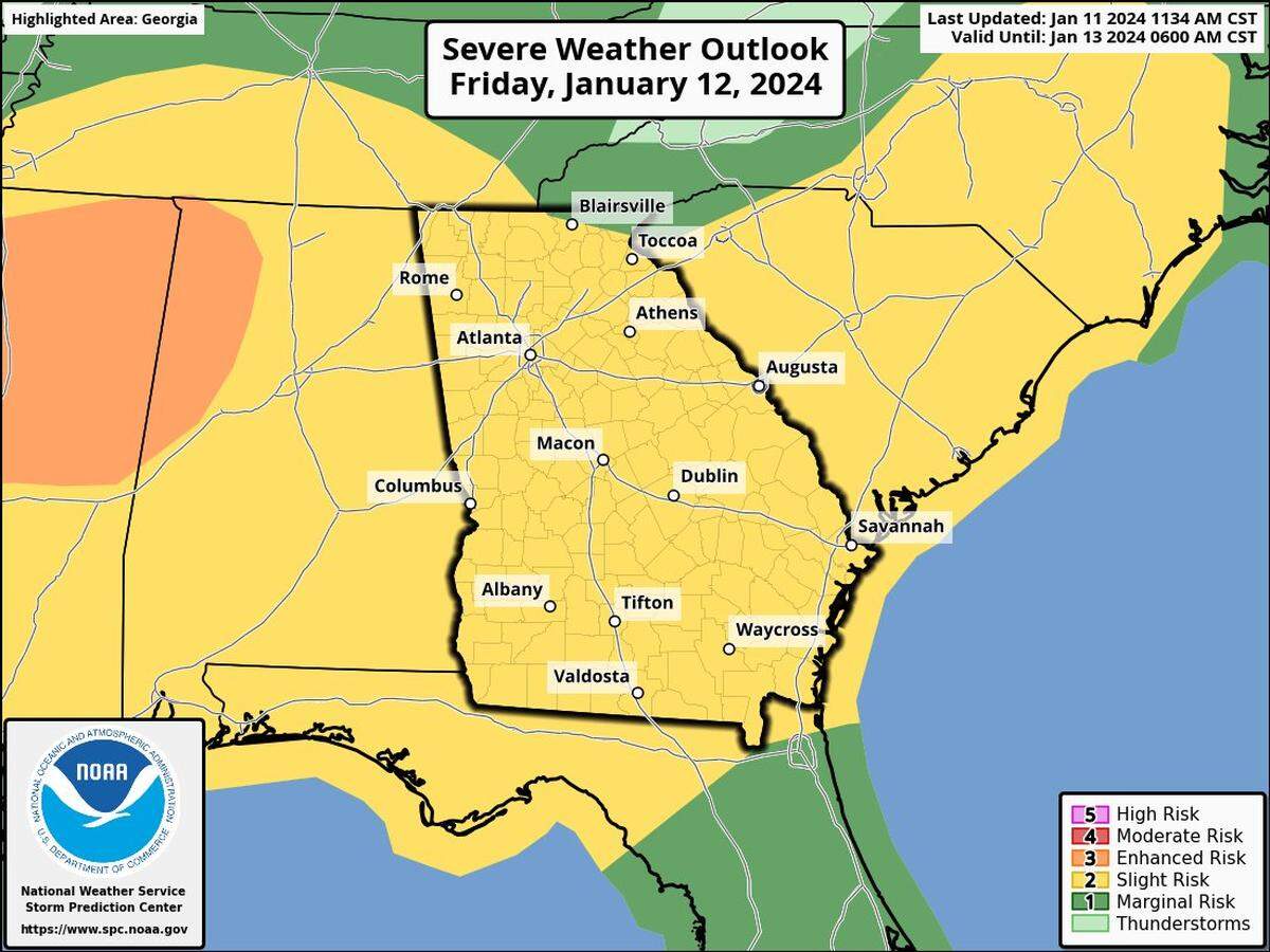
The forecast is predicting Macon to get hit with significant downpours causing flash flooding as well as wind gusts of up to 70 mph bursting through the area.
And with that wind comes the threat of tornadoes.
“Damaging winds and a few tornadoes will be possible, especially south of I-20,” the National Weather Service said on social media.
The National Weather Service has already issued a flood warning for the Ocmulgee River near Macon, which also affects Houston, Twiggs, Monroe, Jones and Bibb counties.
There is also a wind advisory in effect until Saturday for Macon and many surrounding cities.
The timing of the storms
When can we expect to see this storm unfold?
The timing of the severe weather in Macon is expected to begin around 10 a.m. Friday morning and last until around 8 p.m. Friday.
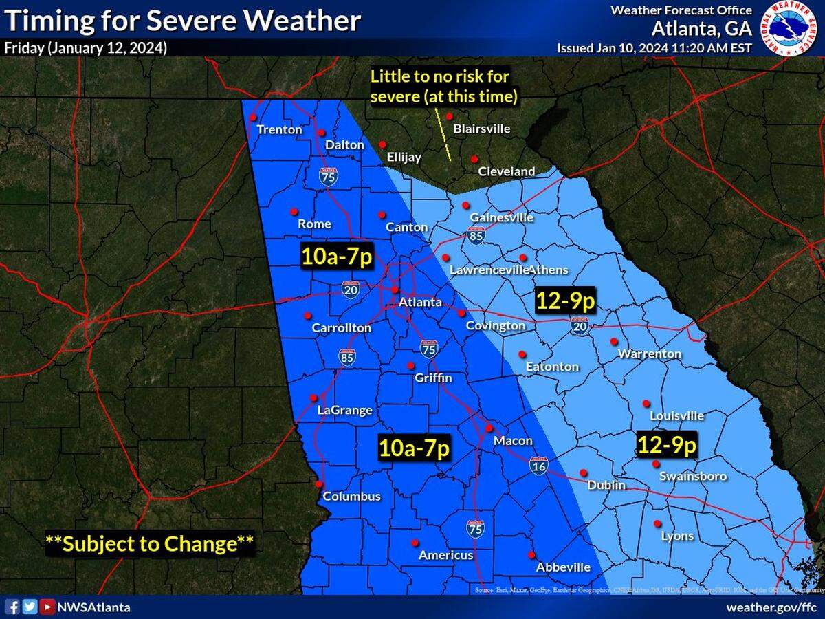
Keep up with the latest forecast on the National Weather Service website and local weather stations.
Are you ready for the severe weather? Comment below or email me at cmadden@mcclatchy.com with any questions or tips
.This story was originally published January 11, 2024 at 3:46 PM.