
Hurricane Idalia is shifting west as it spins out of the Gulf. Here’s what it means for GA
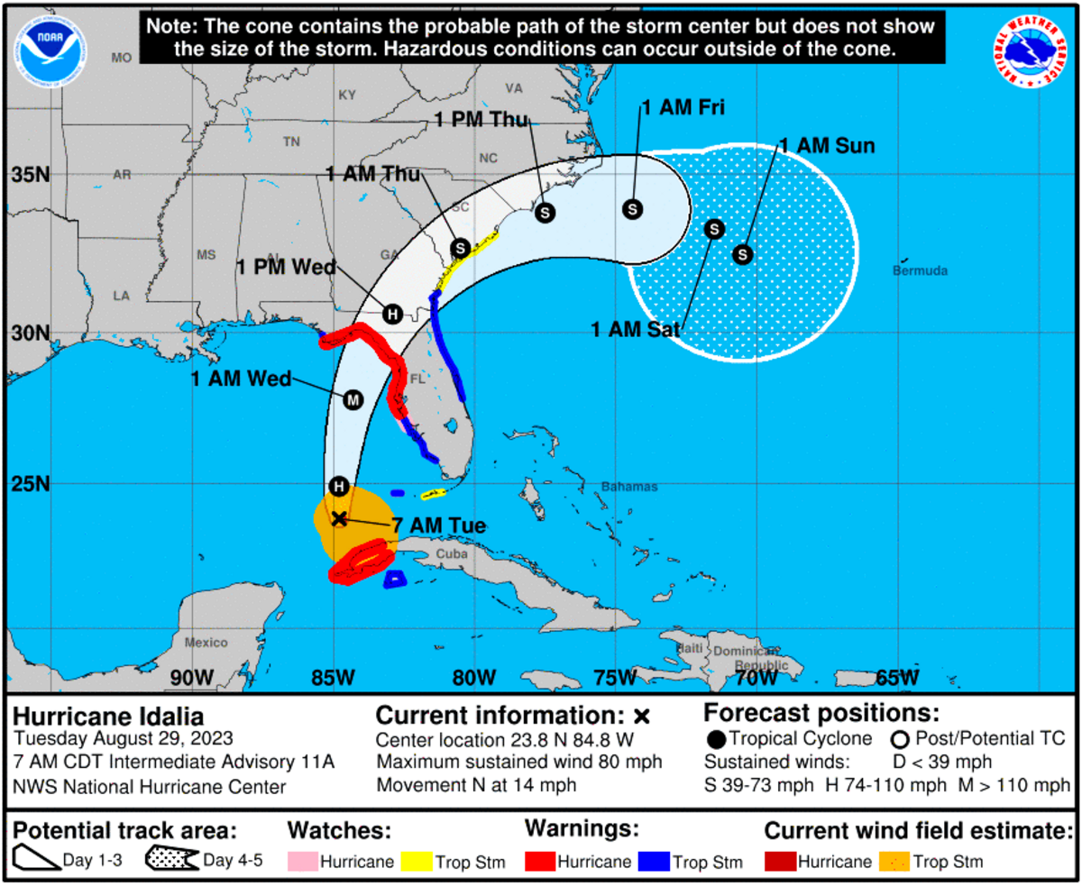
A slight westerly shift in Hurricane Idalia’s course as it churned in the Gulf of Mexico on Tuesday prompted forecasters to expand the storm’s potential affect on Georgia to include areas further inland than first projected.
Idalia was expected to make landfall in northern Florida’s Big Bend region early Wednesday and, during the day, plod through southeastern Georgia toward Savannah. Rain totals from 3 to 6 inches are possible in spots.
The National Weather Service noted that “impacts from winds and heavy rain” may now be felt in much of east and southeastern Middle Georgia, with sustained winds at times up to 30 mph with gusts to 45 mph.
“Brief tornadoes will also be possible in rain bands as Idalia moves onshore and approaches our area,” a weather service statement said.
Forecasters also issued flood watches along a northeasterly arc from Americus to Warner Robins, Macon and Milledgeville, on over to the South Carolina border.
Just southeast of that swath, a tropical storm warning was issued for areas around Cordele, Abbeville, Eastman, McRae-Helena, Alamo and Vidalia.
Hurricane warnings were in effect for locations in far southern Georgia from around Valdosta over to Waycross and the Okefenokee Swamp.
This story was originally published August 29, 2023 at 1:37 PM.