
Here’s what Middle Georgia should expect as Hurricane Idalia surges into the Southeast
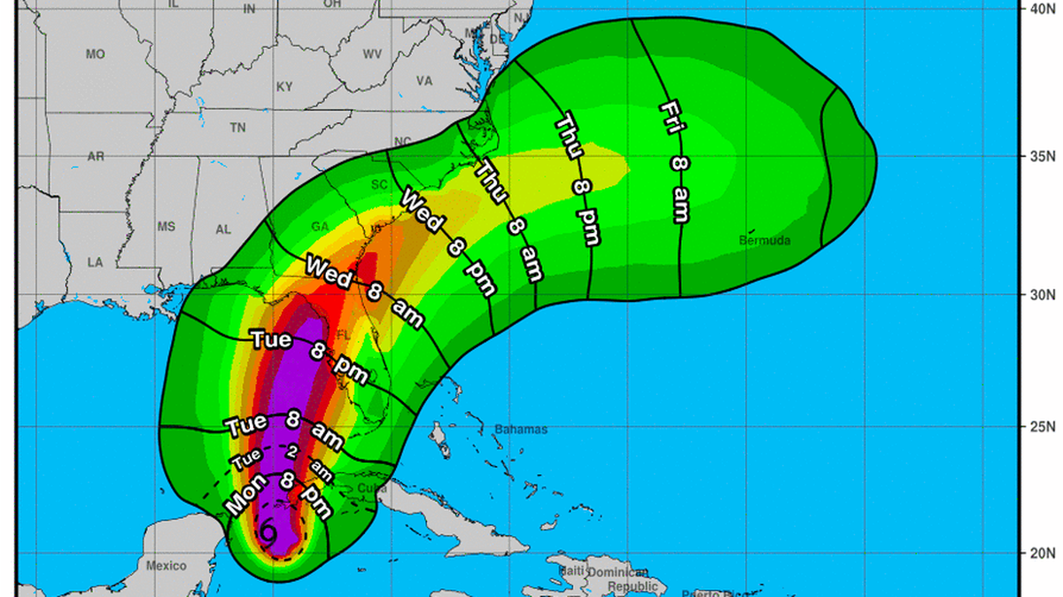
Hurricane Idalia will likely to sweep across southeastern Georgia during the day Wednesday.
The storm’s hefty payload of tropical moisture may spawn severe thunderstorms in the midstate in the run-up to its arrival.
Idalia was forecast to make landfall somewhere in Florida’s Big Bend region roughly south of Valdosta at about daybreak Wednesday and be centered over Savannah by 7 p.m. or so.
Forecaster Dylan Lusk of the weather service’s Peachtree City post said at midday Monday that “the biggest deal right now” for Middle Georgia was “the potential for some very heavy rain over the coming days.”
Such downpours, Lusk said, would be fueled by moist air along an already-stalled frontal boundary, possibly stirring up “bouts of heavy afternoon thunderstorms — even heavier than what we would normally expect.”
Such storms, he added, “are our main concern” for the midstate.
As for Idalia itself, Lusk said, “We’re at a place where very small deviations in the track are going to make big, big differences” in what the storm may have in store for our region.
Should the storm jog westerly, the Macon and Warner Robins areas have the potential to be lashed by 39-mph-plus winds.
“I would be prepared for that, but that’s not necessarily what’s in our forecast right now,” Lusk said. “But, like I said, a small change in the track could mean that those types of impacts could extend (toward the midstate).”
As of Monday afternoon, however, the Wednesday forecast called for 20-to-30-mph winds in Middle Georgia.
This story was originally published August 28, 2023 at 12:42 PM.