Scattered thunderstorms possible for Middle Georgia as Hurricane Isaias skirts the coast
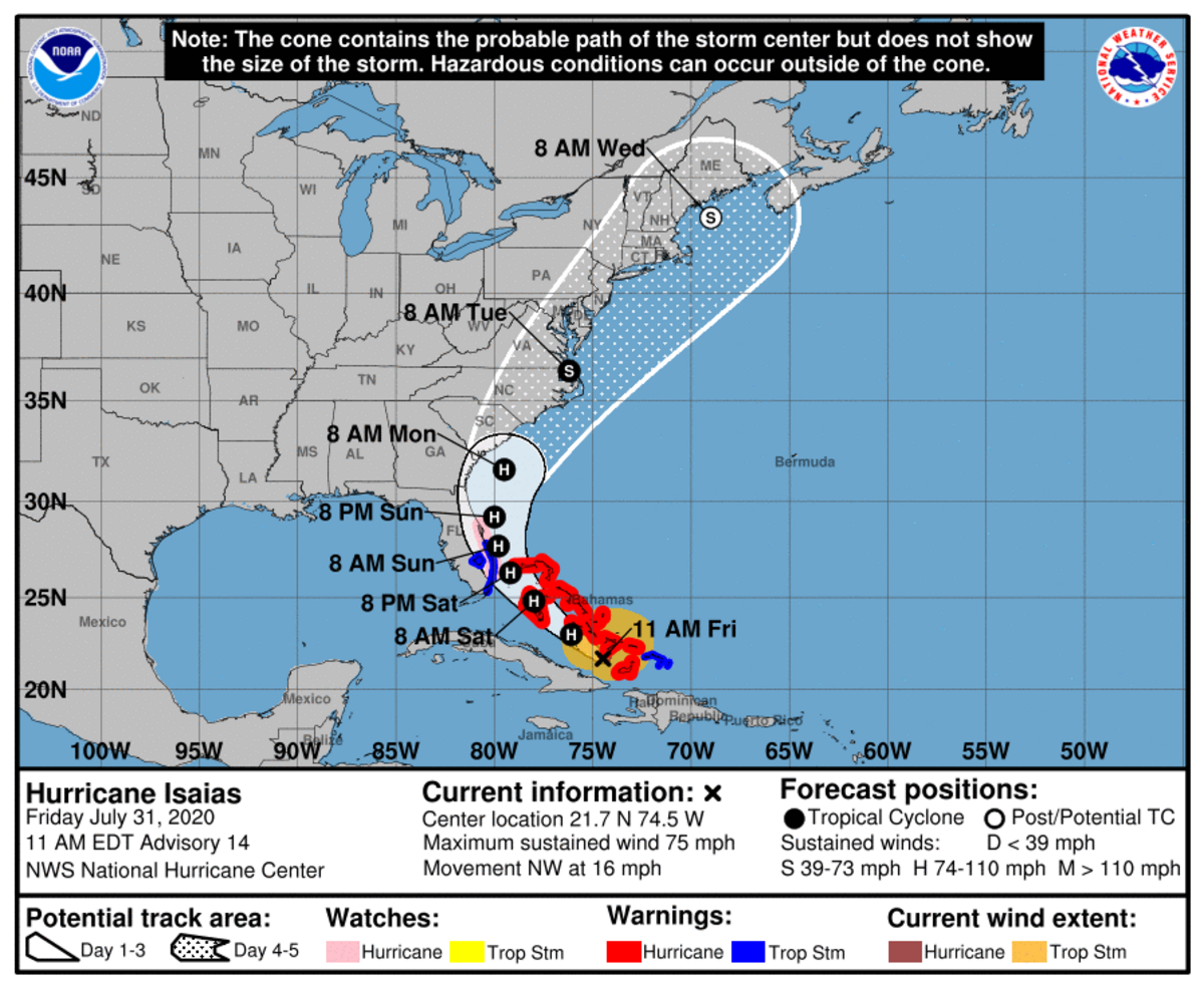
Hurricane Isaias is not expected to directly impact Middle Georgia, though scattered thunderstorms were in the forecast Friday and possibly into the weekend.
“A few storms may be strong to briefly severe with damaging winds, frequent lightning, hail and locally heavy rainfall,” according to the online National Weather forecast Friday. The projected track for the storm shifted slightly west and closer to the Georgia coastline at the NWS 11 a.m. update.
“Scattered thunderstorms are possible across mainly north Georgia on Saturday, then the majority of the area each day thereafter. A few storms may be strong to briefly severe with damaging winds,frequent lightning, hail, and locally heavy rainfall, the NWS said.
Katie Martin, a NWS forecaster based in Peachtree City, said the potential storms possible for Macon and the surrounding area are more of “the summertime popup variety that we often see in the summer.”
“It’s not going to be out of the ordinary for summertime here,” Martin said. “We’re not going to have the like the tropical kind of consistent rain we might have if Isaias was going to be closer to us.”
The forecast for Hurricane Isaias is to kind of skirt the Florida Panhandle on its eastern coast, moving up along the coastline, Martin said.
“We could see a greater concentration of some showers and storms across that area especially as we head into the later part of the weekend like Sunday and Monday,” Martin said. “But that area is going to be on the very far western portion of the moisture that’s coming up with that hurricane.
“So as far some maybe an increase in some rain showers and storms again early next week, not a whole lot of impact ... Aside from rain showers and storms that’s about all that Macon and its surrounding area will see,” she said.