
Any chance of snow for Middle Georgia? Check out the NWS' wintry mix models
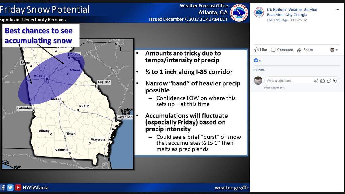
Looking more like more rain than snow for Middle Georgia based on a Thursday afternoon weather update from the National Weather Service at Peachtree City. But light accumulations are still possible for Macon and as far south as Dublin on Friday night.
Also, there's potential for treacherous black ice.
A NWS model showing the best chance to see snow accumulation Friday leaves Macon on the outskirts. Atlanta and Athens could see some accumulation that's expected to melt as the precipitation ends.
Light rain forecast into Friday could become mixed with, or turn into, snow late tonight and Friday across parts of west central and north Georgia., the NWS predicts. The wintry mix is expected to move into parts of the Midstate Friday night.
"As the rain and snow mix moves into central Georgia Friday night, light accumulations are possible as far south as Columbus, Americus and Dublin," the forecast states. "Most, if not all of the accumulation Friday night will be in grassy areas and on elevated surfaces. In addition, much colder temperatures will plunge into the area behind this system Friday night into Saturday morning.
"Although most of the precipitation will be gone by then, residual wet roadways will freeze very quickly prior to any drying that takes place. This black ice scenario would create hazardous travel conditions areawide Friday night into Saturday morning, especially for elevated surfaces such as bridges and overpasses. "
The forecast could change as the weather system develops.
This story was originally published December 7, 2017 at 2:33 PM with the headline "Any chance of snow for Middle Georgia? Check out the NWS' wintry mix models."